Project area
When will work reach my spot?
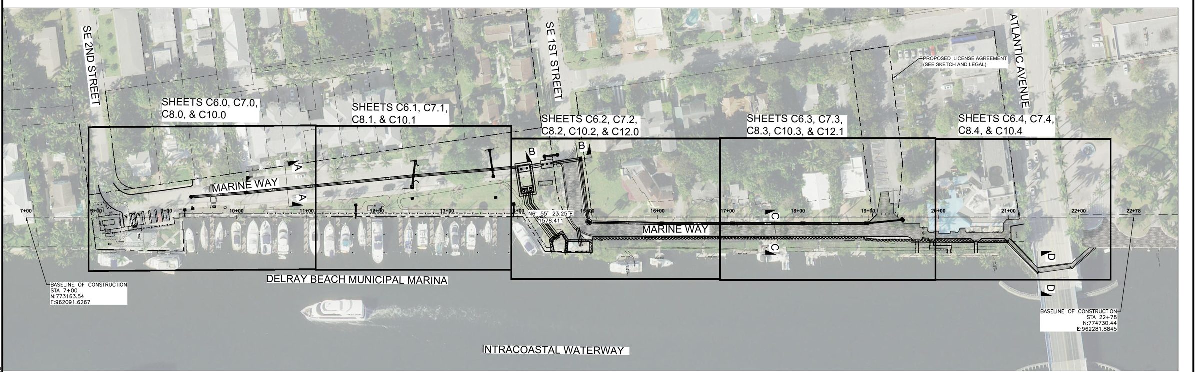
Type your address or tap the map. Move the timeline to see each phase light up where it happens, from SE 2nd Street to East Atlantic Avenue.
01
Phase map
Work areas are approximate, traced by hand from plan sheets C3.0 (key sheet), C5.0, C8.0–C8.4 and S2.00–S2.06 over aerial imagery. They are not survey lines. Dates come from the proposed schedule submitted to the City (Exhibit A.1, 14 September 2026) and will be confirmed when the City executes the GMP amendment. Imagery © Esri, Maxar, Earthstar Geographics. Address search by Esri.
02
Plan key sheet
03
Aerial view
