Before and after

Marine Way today, and as designed

Drag the handle, or focus it and use the arrow keys, to compare today with the City’s design.

01

North Marine Way from above

Aerial photo of North Marine Way today, from SE 1st Street to the Atlantic Avenue bridge
The same aerial with the design drawn on: brick paver street, grass-pave parking, new seawall and cap, and the stormwater pump station
TodayDesign (diagram)
Left: aerial imagery © Esri, Maxar, Earthstar Geographics. Right: a diagram drawn over the same photo from plan sheets C5.0 (Typical Section C-C, north of SE 1st St) and S2.00 (pump station phasing), City of Delray Beach Project 17-047, prepared by WGI. It is approximate and not a rendering.
02

South Marine Way on the plans

Demolition plan sheet C7.1 showing existing conditions along South Marine Way at 102 to 118 Marine Way and the City Marina
Roadway plan sheet C8.1 showing the proposed roadway and drainage for the same stretch
Existing (C7.1)Proposed (C8.1)
Plan sheets C7.1 Demolition Plan and C8.1 Roadway Plan, City of Delray Beach Project 17-047, prepared by WGI. North is to the right.
03

The finished street, in section

Typical section of North Marine Way, north of SE 1st StreetFrom the homes toward the water: 8 foot grass-pave parking, 2 foot valley gutter, 16 foot brick paver street, 2 foot curb and gutter, landscape, the new 1 foot seawall, and the existing mangroves that stay. Grass-pave parking8 ft 2 ft gutter Brick paver street (charcoal/red, herringbone)16 ft, permeable pavers curb New seawall Mangroves stay Intracoastal Below the street: new 36" drainage main, 8" water main and 8" sewer
Simplified from plan sheet C5.0, Typical Section C-C (North Marine Way, stations 15+11 to 18+99). New seawall top elevation 4.2 or 6.0 ft per the plans. Not to scale.

Concept renderings from the City’s Owner’s Representative are shown below. See the phase map · A day on site

04

Renderings of the proposed street

Each rendering is shown next to the photo of existing conditions from the same rendering set. Renderings show design intent; what is built follows the construction plans.
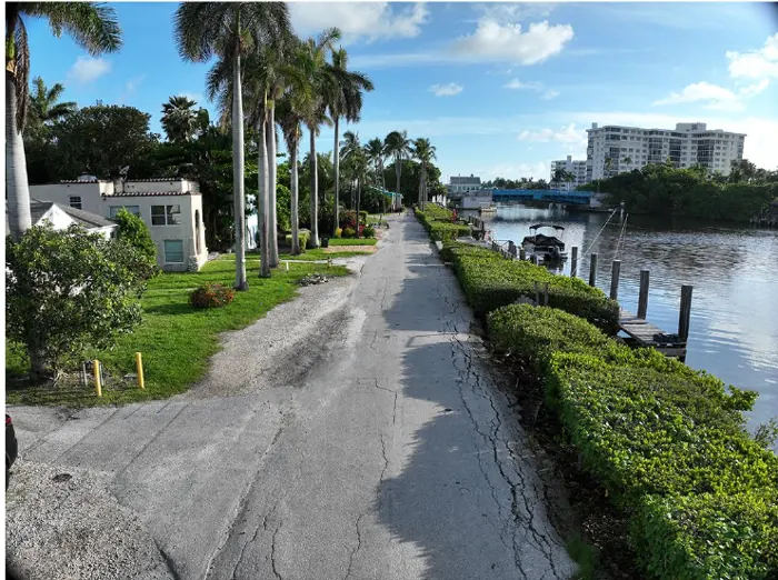
Existing conditions: cracked, patched asphalt on Marine Way looking north, with a hedge along the seawallExisting
Rendering, proposed: a red brick paver street with a curb, landscaping and pedestrian lights along the seawall, looking northRendering, proposed
Marine Way looking north from 60 Marine Way. Rendering, proposed (Baxter & Woodman, the City’s Owner’s Representative).
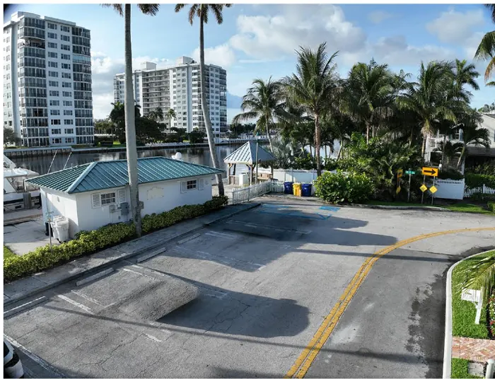
Existing conditions: worn asphalt at the corner of SE 2nd Street and Marine Way near the marina buildingExisting
Rendering, proposed: new pavement with marked parking and centerline at the corner of SE 2nd Street and Marine WayRendering, proposed
Corner of SE 2nd Street and Marine Way. Rendering, proposed (Baxter & Woodman).
Existing conditions: aerial of the corner of SE 1st Street and Marine Way at the marinaExisting
Rendering, proposed: aerial of the corner of SE 1st Street and Marine Way with new landscaping and paving beside the marinaRendering, proposed
Corner of SE 1st Street and Marine Way. Rendering, proposed (Baxter & Woodman).
05

Marine Way today

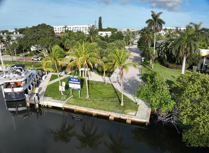
Existing conditions: boats tied up at the docks along the Marine Way seawall, seen from above the Intracoastal
Docks and seawall along North Marine Way.
Existing conditions: the narrow, worn street on Marine Way with homes on one side
The street today.

Existing conditions, before construction. Photos by Man-Con, Inc., 10 March 2026.